Led by me, with Barry and Gordon. Weather dry but grey - some mud underfoot. Views a bit hazy. 8.7 miles.
We parked at Foxton Locks long-stay car park, and began our walk by following the path to the Locks, this time visiting the inclined plane on the way down.
 |
| The grey shape is a heron making its getaway. |
 |
| Info about the boat lift |
 |
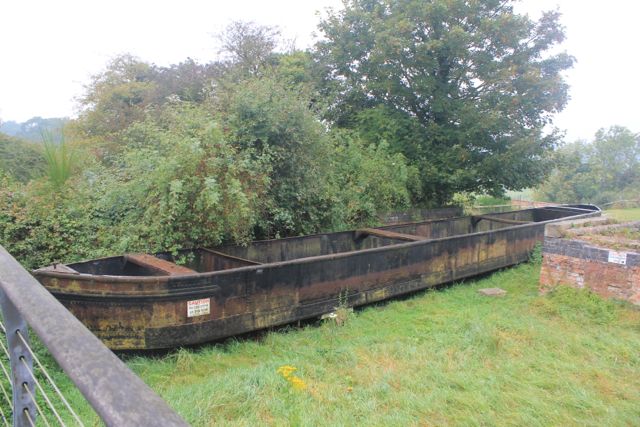
| The inclined plane |
 |
| CAUTION - do not climb on this boat. |
 |
"I can remember the big wheels with wires around them, and the big chimney with smoke coming out of the top. I thought that when we went down the tank would tip and the water splash out. I think mother was afraid too, but we went gently down, the other tank passing us halfway; it took just over five minutes." Mrs Daisy Dainty talking about when she went on the Inclined Plane Boat Lift in 1909. |

From the bottom lock we crossed over Bridge 62, and walked along the tow-path as far as the footbridge. We turned east towards Gumley and followed the same route as here, all the way to Saddington.

There were wide, though hazy views today - hence no landscape photos. When we reached Saddington, we turned left along Main Street past the pub, and turned left into the Riding School, just before the church.
We joined a track/driveway and followed this as far as the Mowsley Road. We crossed and took the footpath opposite. The hedgerow was well-supplied with blackberries. Our path headed south and took us into the valley where we crossed Saddington Brook via a footbridge, and then walked with Mowsley Brook on our right.
A couple of hundred yards or so along, we took a clearly marked footpath uphill to our left, and used a redundant stile as a seat for our snack break, before walking the few extra yards to the Mowsley Road which goes along the top of the ridge. A right turn and a short distance took us to a bridleway on the left of the road.
The path turned almost due south and was clearly way-marked most of the way, though we strayed slightly joining a track which took us up hill to the village of Laughton (pronounced Lawton).
 |
| The view from the bench |
 |
| Time to move, guys! |
We continued a short distance along the road, and found the turning on the left. Our path veered off to the left from the track, through a stile in a hedge, and past a pond near the Mill Mound. We had no problem following the route as it took us to the highest point of the walk, at 168 m (562 ft) just by a T junction. We crossed the road and took a footpath which heads north east, quite steeply downhill before swinging a little more to the east andquite steeply downhill towards Gumley Lodge. Just past the house we turned right, hugging the hedgerow, then up gently to meet a small road towards Theddingworth. We turned left for a few yards, then took a footpath which cuts off the corner and took us to the Foxton Road. We turned right and followed this for another half mile or so back to the car park.
No comments:
Post a Comment